


How AiDASH’s Technology Helps Reduce Wildfire Risks: An Interview with CEO Abhishek Singh
(Source: Shutterstock)
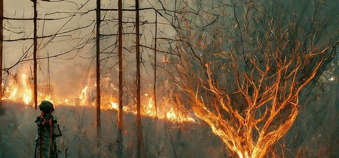
The economic impact of the recent Los Angeles wildfires is estimated to be between $95B and $164B, according to a report by UCLA Anderson. The wildfires caused more than 20,000 acres to be torched and forced the evacuation of over 150,000 people in the Los Angeles area. This makes it one of the costliest disasters in U.S. history.
Unfortunately, this was not just an isolated incident but part of a broader trend of rising wildfire risks in California. Other states, like Oregon, Washington, Colorado, and Arizona, also experience major wildfires. Globally, countries such as Australia, Brazil, and Greece face similar devastation.
The rise in catastrophic wildfires over the past two decades has drawn more attention to wildfire prevention, mitigation, and climate resilience. Various solutions have emerged to combat this threat, including the use of AI to enhance early detection, predict fire behavior, and improve response efforts.

(Source: Shutterstock)
AiDASH, an AI-powered satellite analytics company, is taking an innovative approach to combat the risk of wildfires. They have developed a Climate Risk Intelligence System (CRIS) that uses satellite imagery and AI algorithms to identify potential hazards, such as overgrown trees near power lines, allowing for early intervention. Their focus with CRIS is to prevent and mitigate wildfires caused by or near power lines.
What is the link between power lines and wildfires? Between 2016 and 2020, electrical power networks caused 19% of the wildfires that occurred in those five years. Power lines can spark wildfires due to contact with vegetation, downed lines, equipment failures, or conductor slap, which occurs when power lines sway or move excessively. If the conditions are dry, a single fault near the powerlines can spark a major wildfire.
According to a report by the California Wildfire Safety Advisory Board (CWSAD), “Powerlines coming into contact with vegetation is responsible for nearly 40 percent of all utility ignitions in California’s highest risk areas and has been behind many of the State’s most catastrophic wildfires.”
These statistics show that power lines are a significant ignition source in high-risk areas. AIwire interviewed the CEO of AiDASH, Abhishek Singh, to better understand how their solutions can help reduce the risk of wildfires.
Singh shared that the U.S. has 7 million miles of power lines with over 200 million poles and billions of trees near them. Historically, utility companies have relied on the manual inspection of each mile, which is slow, inefficient, and often ineffective.
With CRIS, AiDASH helps identify wildfire risks by using satellite imagery to monitor trees, power lines, and surrounding vegetation. It can detect overgrown or unhealthy trees that might fall on power lines, assess dry conditions that increase fire danger, and track wind patterns that could spread flames. This allows utilities to take action before small issues turn into major wildfires.

(Source: Shutterstock)
“We can scan tens of thousands of miles in a single day using satellites, and this is our biggest advantage,” shared Singh. "We use 30cm to 50cm high-resolution imagery to assess trees: their height, health, and potential to fall on power lines. We also evaluate wind conditions, tree growth, and moisture content to determine the likelihood of ignition and wildfire spread. All these factors are measurable with satellite technology and AI."
According to Singh, the advances in satellite imagery allow them to gather more in-depth insights, such as moisture content, to allow them to compute the fuel load and determine the likelihood of an ignition. AI plays a key role by automating this process, allowing AiDASH to cover vast regions.
Utility companies are the primary customers for AiDASH. CRIS offers these companies a solution to prevent utility-related wildfires. With timely information, the utility companies can de-energize the power lines, save the infrastructure, and reduce the impact of the wildfires. As a complementary technology, CRIS can be integrated with other solutions, including AI-enabled surveillance cameras, to allow for a multi-pronged strategy to combat wildfires.
CRIS has the capability to help multiple entities with wildfire detection and monitoring, and this may help expand the customer base. “Multiple entities need to perform several actions when wildfires occur, " explains Singh. “The fire department must act to contain the wildfire, and even if our data isn’t directly requested, it could be shared with them as a matter of policy.”
“Our satellite and AI technology enables earlier detection, giving responders more time. Additionally, by providing insights to utilities, we help prevent many wildfires - something traditional camera companies don’t offer. It's a complementary approach to wildfire management.”

(Source: Shutterstock)
Singh shared that AiDASH has over 125 utility companies using its product line. The use of the CRIS solution specifically for wildfire management is still in its initial phase. However, it is being deployed in a couple of pilot programs. The aim is to thoroughly test the technology before it is made widely available.
AiDASH shared a case study where Avista, a utility provider in the Northwestern U.S., integrated CRIS to improve storm response and outage prediction. Using 20 years of historical weather data, CRIS achieved over 80% prediction accuracy, helping Avista reduce restoration times and improve operational efficiency. AiDASH offers a promising and innovative approach to wildfire prevention and management. It could play a key role in mitigating disasters and protecting communities.


